
Thank you for supporting this site ❤️
Make a donation
Make a donation
Apulia topographic map
Click on the map to display elevation.
Thank you for supporting this site ❤️
Make a donation
Make a donation
About this map
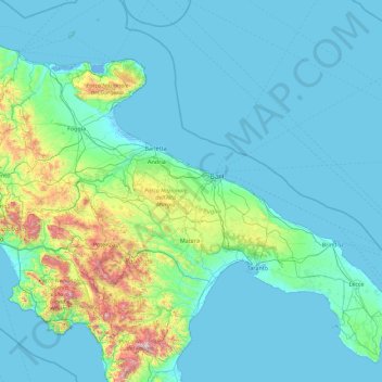
Name: Apulia topographic map, elevation, terrain.
Location: Apulia, Italy (39.78959 14.93419 42.22648 18.52051)
Average elevation: 167 m
Minimum elevation: -4 m
Maximum elevation: 2,151 m
Thank you for supporting this site ❤️
Make a donation
Make a donation
Other topographic maps
Click on a map to view its topography, its elevation and its terrain.