
Rajarhat topographic map
Interactive map
Click on the map to display elevation.
About this map
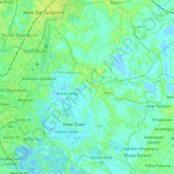
Name: Rajarhat topographic map, elevation, terrain.
Location: Rajarhat, North 24 Parganas, West Bengal, India (22.55607 88.39162 22.68522 88.55577)
Average elevation: 4 m
Minimum elevation: -3 m
Maximum elevation: 12 m
Other topographic maps
Click on a map to view its topography, its elevation and its terrain.
Purulia
India > West Bengal > Purulia - II
Purulia is located at 23°20′N 86°22′E / 23.33°N 86.37°E / 23.33; 86.37. It has an average elevation of 228 metres (748 feet).
Average elevation: 241 m
Habra
India > West Bengal > Habra - I
Habra is located at 22°50′N 88°38′E / 22.83°N 88.63°E / 22.83; 88.63. It has an average elevation of 13 metres (42 feet).
Average elevation: 7 m