
Thank you for supporting this site ❤️
Make a donation
Make a donation
Kulai topographic map
Click on the map to display elevation.
Thank you for supporting this site ❤️
Make a donation
Make a donation
About this map
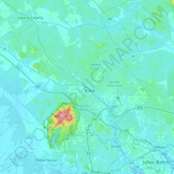
Name: Kulai topographic map, elevation, terrain.
Location: Kulai, Iskandar Malaysia, Johor, Malaysia (1.52312 103.36291 1.80539 103.73823)
Average elevation: 40 m
Minimum elevation: -2 m
Maximum elevation: 625 m
Thank you for supporting this site ❤️
Make a donation
Make a donation
Other topographic maps
Click on a map to view its topography, its elevation and its terrain.