
Thank you for supporting this site ❤️
Make a donation
Make a donation
Ōkato topographic map
Click on the map to display elevation.
Thank you for supporting this site ❤️
Make a donation
Make a donation
About this map
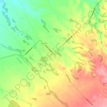
Name: Ōkato topographic map, elevation, terrain.
Location: Ōkato, New Plymouth District, Taranaki, 4335, New Zealand (-39.21101 173.85998 -39.17101 173.89998)
Average elevation: 98 m
Minimum elevation: 35 m
Maximum elevation: 159 m
New Plymouth District trails, hiking, mountain biking, running and outdoor activities
Thank you for supporting this site ❤️
Make a donation
Make a donation
Other topographic maps
Click on a map to view its topography, its elevation and its terrain.