
Thank you for supporting this site ❤️
Make a donation
Make a donation
Sobral topographic map
Click on the map to display elevation.
Thank you for supporting this site ❤️
Make a donation
Make a donation
About this map
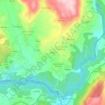
Name: Sobral topographic map, elevation, terrain.
Location: Sobral, Xeve, Pontevedra, Galicia, 36150, España (42.44334 -8.60969 42.48334 -8.56969)
Average elevation: 110 m
Minimum elevation: 1 m
Maximum elevation: 309 m
Thank you for supporting this site ❤️
Make a donation
Make a donation
Other topographic maps
Click on a map to view its topography, its elevation and its terrain.