
Thank you for supporting this site ❤️
Make a donation
Make a donation
Butler County topographic map
Click on the map to display elevation.
Thank you for supporting this site ❤️
Make a donation
Make a donation
About this map
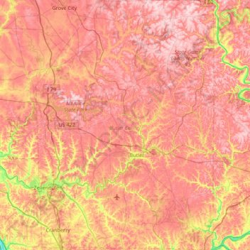
Name: Butler County topographic map, elevation, terrain.
Location: Butler County, Pennsylvania, United States (40.66905 -80.16529 41.17312 -79.69009)
Average elevation: 376 m
Minimum elevation: 205 m
Maximum elevation: 485 m
Thank you for supporting this site ❤️
Make a donation
Make a donation
Other topographic maps
Click on a map to view its topography, its elevation and its terrain.