
Thank you for supporting this site ❤️
Make a donation
Make a donation
Upland topographic map
Click on the map to display elevation.
Thank you for supporting this site ❤️
Make a donation
Make a donation
Upland
Upland is a city in San Bernardino County, California, United States on the border with neighboring Los Angeles County. The municipality is located at an elevation of 1,242 feet (379 m). As of the 2020 census, the city had a population of 79,040, up from 73,732 at the 2010 census.
Thank you for supporting this site ❤️
Make a donation
Make a donation
About this map
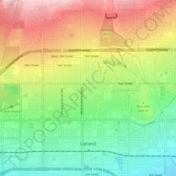
Name: Upland topographic map, elevation, terrain.
Location: Upland, San Bernardino County, California, United States (34.08694 -117.70441 34.15233 -117.61959)
Average elevation: 457 m
Minimum elevation: 324 m
Maximum elevation: 650 m
Thank you for supporting this site ❤️
Make a donation
Make a donation
Other topographic maps
Click on a map to view its topography, its elevation and its terrain.