
Thank you for supporting this site ❤️
Make a donation
Make a donation
Dewey topographic map
Click on the map to display elevation.
Thank you for supporting this site ❤️
Make a donation
Make a donation
About this map
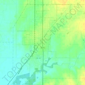
Name: Dewey topographic map, elevation, terrain.
Location: Dewey, Washington County, Oklahoma, 74029, United States (36.77152 -95.95271 36.81730 -95.90730)
Average elevation: 211 m
Minimum elevation: 200 m
Maximum elevation: 223 m
Thank you for supporting this site ❤️
Make a donation
Make a donation
Other topographic maps
Click on a map to view its topography, its elevation and its terrain.