
Ipo Dam topographic map
Interactive map
Click on the map to display elevation.
Ipo Dam
The spill level of the dam is at an elevation of 101 metres and it has seven radial floodgates. The watershed topography is characterised by mountainous terrain similar to the Angat Reservoir Watershed with moderate forest cover. The watershed has an area of about 70 square kilometers and receives an average annual rainfall of 3,500 millimeters. Tributaries to the Angat River at this section include the Ipo, Sapa Pako and Sapa Anginon Rivers. These tributaries drain into the Angat River from the eastern section of the watershed.
About this map
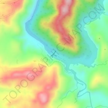
Name: Ipo Dam topographic map, elevation, terrain.
Average elevation: 174 m
Minimum elevation: 66 m
Maximum elevation: 304 m