
Thank you for supporting this site ❤️
Make a donation
Make a donation
Kielder topographic map
Click on the map to display elevation.
Thank you for supporting this site ❤️
Make a donation
Make a donation
About this map
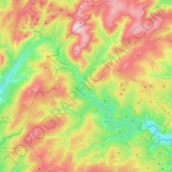
Name: Kielder topographic map, elevation, terrain.
Location: Kielder, Northumberland, North East, England, United Kingdom (55.12961 -2.68981 55.32332 -2.44444)
Average elevation: 336 m
Minimum elevation: 127 m
Maximum elevation: 602 m
Thank you for supporting this site ❤️
Make a donation
Make a donation
Other topographic maps
Click on a map to view its topography, its elevation and its terrain.