
Thank you for supporting this site ❤️
Make a donation
Make a donation
Link Lake topographic map
Click on the map to display elevation.
Thank you for supporting this site ❤️
Make a donation
Make a donation
About this map
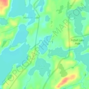
Name: Link Lake topographic map, elevation, terrain.
Location: Link Lake, Lake County, Minnesota, United States (48.14165 -91.07129 48.14774 -91.06151)
Average elevation: 452 m
Minimum elevation: 435 m
Maximum elevation: 488 m
Thank you for supporting this site ❤️
Make a donation
Make a donation
Other topographic maps
Click on a map to view its topography, its elevation and its terrain.
North Shore Mining/Lake Superior Overlook
United States > Minnesota > Lake County > Silver Bay
Average elevation: 252 m
Thank you for supporting this site ❤️
Make a donation
Make a donation
Thank you for supporting this site ❤️
Make a donation
Make a donation