
Thank you for supporting this site ❤️
Make a donation
Make a donation
Peebles topographic map
Click on the map to display elevation.
Thank you for supporting this site ❤️
Make a donation
Make a donation
About this map
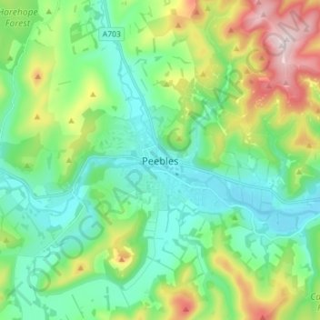
Name: Peebles topographic map, elevation, terrain.
Location: Peebles, Scottish Borders, Scotland, EH45 8SL, United Kingdom (55.61176 -3.22855 55.69176 -3.14855)
Average elevation: 275 m
Minimum elevation: 148 m
Maximum elevation: 598 m
Thank you for supporting this site ❤️
Make a donation
Make a donation
Other topographic maps
Click on a map to view its topography, its elevation and its terrain.