
Thank you for supporting this site ❤️
Make a donation
Make a donation
Okhaldhunga topographic map
Click on the map to display elevation.
Thank you for supporting this site ❤️
Make a donation
Make a donation
About this map
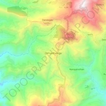
Name: Okhaldhunga topographic map, elevation, terrain.
Location: Okhaldhunga, Siddhicharan, ओखलढुङ्गा, Province n°1, Népal (27.27798 86.46140 27.35798 86.54140)
Average elevation: 1,566 m
Minimum elevation: 882 m
Maximum elevation: 2,619 m
Thank you for supporting this site ❤️
Make a donation
Make a donation