
Forest Ranch topographic map
Interactive map
Click on the map to display elevation.
About this map
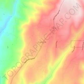
Name: Forest Ranch topographic map, elevation, terrain.
Location: Forest Ranch, Butte County, California, United States (39.86211 -121.69275 39.90211 -121.65275)
Average elevation: 672 m
Minimum elevation: 302 m
Maximum elevation: 918 m