
Thank you for supporting this site ❤️
Make a donation
Make a donation
Tuburan topographic map
Click on the map to display elevation.
Thank you for supporting this site ❤️
Make a donation
Make a donation
About this map
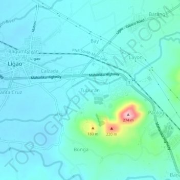
Name: Tuburan topographic map, elevation, terrain.
Location: Tuburan, Albay, Bicol Region, 4504, Philippines (13.21437 123.53367 13.25437 123.57367)
Average elevation: 70 m
Minimum elevation: 41 m
Maximum elevation: 258 m
Thank you for supporting this site ❤️
Make a donation
Make a donation
Other topographic maps
Click on a map to view its topography, its elevation and its terrain.