
Thank you for supporting this site ❤️
Make a donation
Make a donation
Cleveland topographic map
Click on the map to display elevation.
Thank you for supporting this site ❤️
Make a donation
Make a donation
About this map
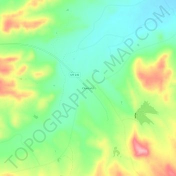
Name: Cleveland topographic map, elevation, terrain.
Location: Cleveland, Blaine County, Montana, United States (48.24944 -109.17267 48.28944 -109.13267)
Average elevation: 1,091 m
Minimum elevation: 1,036 m
Maximum elevation: 1,181 m
Thank you for supporting this site ❤️
Make a donation
Make a donation
Other topographic maps
Click on a map to view its topography, its elevation and its terrain.