
Oguis topographic map
Click on the map to display elevation.
About this map
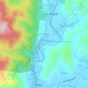
Name: Oguis topographic map, elevation, terrain.
Location: Oguis, Catanduanes, Bicol Region, 4801, Philippines (13.60664 124.27994 13.64664 124.31994)
Average elevation: 146 m
Minimum elevation: -29 m
Maximum elevation: 606 m
Other topographic maps
Click on a map to view its topography, its elevation and its terrain.