
Steyr topographic map
Interactive map
Click on the map to display elevation.
About this map
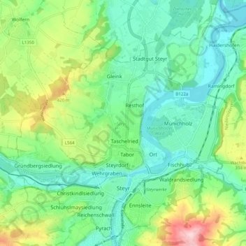
Name: Steyr topographic map, elevation, terrain.
Location: Steyr, Upper Austria, 4400, Austria (48.02358 14.37622 48.08891 14.46993)
Average elevation: 341 m
Minimum elevation: 274 m
Maximum elevation: 500 m