
Thank you for supporting this site ❤️
Make a donation
Make a donation
Worcester topographic map
Click on the map to display elevation.
Thank you for supporting this site ❤️
Make a donation
Make a donation
About this map
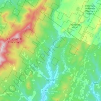
Name: Worcester topographic map, elevation, terrain.
Location: Worcester, Washington County, Vermont, 05682, United States (44.34543 -72.65434 44.47938 -72.49356)
Average elevation: 461 m
Minimum elevation: 200 m
Maximum elevation: 1,086 m
Thank you for supporting this site ❤️
Make a donation
Make a donation