
Rifugio degli Angeli topographic map
Interactive map
Click on the map to display elevation.
About this map
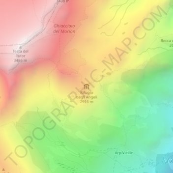
Name: Rifugio degli Angeli topographic map, elevation, terrain.
Average elevation: 2,707 m
Minimum elevation: 1,903 m
Maximum elevation: 3,461 m
Other topographic maps
Click on a map to view its topography, its elevation and its terrain.
Rifugio Mario Bezzi
Italië > Valle d'Aosta > Valgrisenche > Surier
Rifugio Mario Bezzi, Strada Regionale n. 25 della Valgrisenche, Surier, Valgrisenche, Valle d'Aosta, Italië
Average elevation: 2,564 m