
Thank you for supporting this site ❤️
Make a donation
Make a donation
Nakanojo topographic map
Click on the map to display elevation.
Thank you for supporting this site ❤️
Make a donation
Make a donation
About this map
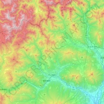
Name: Nakanojo topographic map, elevation, terrain.
Location: Nakanojo, Agatsuma County, Gunma Prefecture, Japan (36.55882 138.51403 36.76417 138.92069)
Average elevation: 882 m
Minimum elevation: 172 m
Maximum elevation: 2,159 m
Thank you for supporting this site ❤️
Make a donation
Make a donation