
Crawford County topographic map
Interactive map
Click on the map to display elevation.
About this map
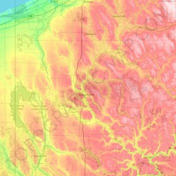
Name: Crawford County topographic map, elevation, terrain.
Location: Crawford County, Pennsylvania, United States of America (41.48043 -80.51939 41.85148 -79.61205)
Average elevation: 382 m
Minimum elevation: 171 m
Maximum elevation: 573 m
Other topographic maps
Click on a map to view its topography, its elevation and its terrain.
South Mountain Park
United States of America > Pennsylvania > Lower Saucon Township > Star Village
Average elevation: 169 m
Clover Hill
United States of America > Pennsylvania > West Pike Run Township > Clover Hill
Average elevation: 347 m