
Morrisville topographic map
Interactive map
Click on the map to display elevation.
About this map
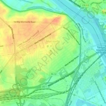
Name: Morrisville topographic map, elevation, terrain.
Location: Morrisville, Bucks County, Pennsylvania, United States (40.19390 -74.80325 40.22189 -74.76067)
Average elevation: 21 m
Minimum elevation: 2 m
Maximum elevation: 44 m
Other topographic maps
Click on a map to view its topography, its elevation and its terrain.
Feasterville
United States > Pennsylvania > Bucks County > Lower Southampton Township
Average elevation: 66 m