
Thank you for supporting this site ❤️
Make a donation
Make a donation
Ayton topographic map
Click on the map to display elevation.
Thank you for supporting this site ❤️
Make a donation
Make a donation
About this map
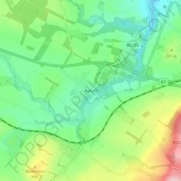
Name: Ayton topographic map, elevation, terrain.
Location: Ayton, Scottish Borders, Scotland, TD14 5RU, United Kingdom (55.82236 -2.14288 55.86236 -2.10288)
Average elevation: 75 m
Minimum elevation: 11 m
Maximum elevation: 213 m
Thank you for supporting this site ❤️
Make a donation
Make a donation
Other topographic maps
Click on a map to view its topography, its elevation and its terrain.