
Castellabate topographic map
Interactive map
Click on the map to display elevation.
About this map
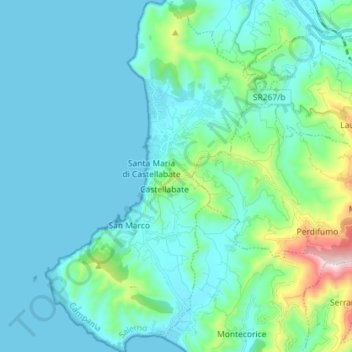
Name: Castellabate topographic map, elevation, terrain.
Location: Castellabate, SA, Kampanien, Italien (40.22832 14.89990 40.33784 15.00630)
Average elevation: 111 m
Minimum elevation: 0 m
Maximum elevation: 768 m