
Thank you for supporting this site ❤️
Make a donation
Make a donation
Kottakombur topographic map
Click on the map to display elevation.
Thank you for supporting this site ❤️
Make a donation
Make a donation
About this map
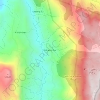
Name: Kottakombur topographic map, elevation, terrain.
Location: Kottakombur, Devikulam, Idukki District, Kerala, India (10.18368 77.23713 10.22368 77.27713)
Average elevation: 1,919 m
Minimum elevation: 1,493 m
Maximum elevation: 2,426 m
Thank you for supporting this site ❤️
Make a donation
Make a donation
Other topographic maps
Click on a map to view its topography, its elevation and its terrain.
Anamudi Shola National Park
India > Kerala > Devikulam > Marayoor > Champakkad
Average elevation: 1,858 m
Thank you for supporting this site ❤️
Make a donation
Make a donation