
Ohiwa topographic map
Interactive map
Click on the map to display elevation.
About this map
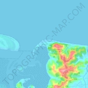
Name: Ohiwa topographic map, elevation, terrain.
Location: Ohiwa, Ōpōtiki District, Bay of Plenty, 3198, New Zealand (-38.00876 177.13937 -37.96876 177.17937)
Average elevation: 11 m
Minimum elevation: 0 m
Maximum elevation: 115 m
Ōpōtiki District trails, hiking, mountain biking, running and outdoor activities