
Thank you for supporting this site ❤️
Make a donation
Make a donation
Lindsay Lane topographic map
Click on the map to display elevation.
Thank you for supporting this site ❤️
Make a donation
Make a donation
About this map
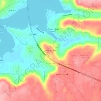
Name: Lindsay Lane topographic map, elevation, terrain.
Average elevation: 249 m
Minimum elevation: 179 m
Maximum elevation: 335 m
Thank you for supporting this site ❤️
Make a donation
Make a donation
Other topographic maps
Click on a map to view its topography, its elevation and its terrain.
Lake Guntersville State Park
United States > Alabama > Marshall County > Guntersville
Average elevation: 242 m