
Mount Dulang-Dulang topographic map
Interactive map
Click on the map to display elevation.
About this map
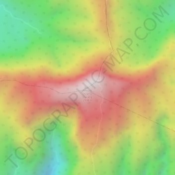
Name: Mount Dulang-Dulang topographic map, elevation, terrain.
Average elevation: 2,448 m
Minimum elevation: 1,925 m
Maximum elevation: 2,896 m
Mount Dulang-dulang, dubbed by Filipino mountaineers as "D2" and also known as Mount Katanglad, is the highest elevation peak in the Kitanglad Mountain Range, located in the north central portion of the province of Bukidnon in the island of Mindanao. It is the second highest mountain of the Philippines at 2,941 metres (9,649 ft) above sea level, second only to Mount Apo of Davao at 2,956 m (9,698 ft) and slightly higher than Mount Pulag of Luzon, the third highest at 2,928 m (9,606 ft).