
Thank you for supporting this site ❤️
Make a donation
Make a donation
Garden City topographic map
Click on the map to display elevation.
Thank you for supporting this site ❤️
Make a donation
Make a donation
About this map
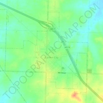
Name: Garden City topographic map, elevation, terrain.
Location: Garden City, Cass County, Missouri, United States (38.54822 -94.22128 38.57808 -94.17480)
Average elevation: 278 m
Minimum elevation: 261 m
Maximum elevation: 303 m
Thank you for supporting this site ❤️
Make a donation
Make a donation
Other topographic maps
Click on a map to view its topography, its elevation and its terrain.