
Cantaura topographic map
Interactive map
Click on the map to display elevation.
About this map
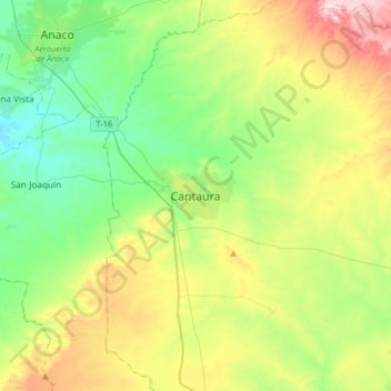
Name: Cantaura topographic map, elevation, terrain.
Average elevation: 251 m
Minimum elevation: 155 m
Maximum elevation: 443 m
Other topographic maps
Click on a map to view its topography, its elevation and its terrain.
Cerro La Cueva del Tigre
Venezuela > Estado Anzoátegui > Municipio Freites > Mundo Nuevo
Cerro La Cueva del Tigre, Mundo Nuevo, Parroquia Libertador, Municipio Freites, Estado Anzoátegui, Venezuela
Average elevation: 965 m
Plaza Pedro María Freites
Venezuela > Estado Anzoátegui > Municipio Freites > Cantaura
Plaza Pedro María Freites, Sector Puerto Colón, Cantaura, Parroquia Cantaura, Municipio Freites, Estado Anzoátegui, Venezuela
Average elevation: 241 m