
Thank you for supporting this site ❤️
Make a donation
Make a donation
Kaysville topographic map
Click on the map to display elevation.
Thank you for supporting this site ❤️
Make a donation
Make a donation
About this map
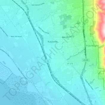
Name: Kaysville topographic map, elevation, terrain.
Location: Kaysville, Davis County, Utah, 84037, United States (40.99460 -111.99459 41.06013 -111.89924)
Average elevation: 1,353 m
Minimum elevation: 1,280 m
Maximum elevation: 1,899 m
Thank you for supporting this site ❤️
Make a donation
Make a donation