
Fasano topographic map
Interactive map
Click on the map to display elevation.
About this map
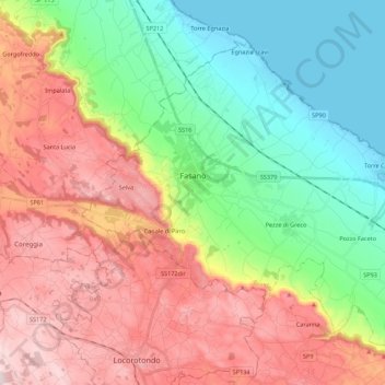
Name: Fasano topographic map, elevation, terrain.
Location: Fasano, Brindisi, Apulië, Italië (40.76038 17.29534 40.89222 17.50606)
Average elevation: 203 m
Minimum elevation: -3 m
Maximum elevation: 445 m
Other topographic maps
Click on a map to view its topography, its elevation and its terrain.