
Thank you for supporting this site ❤️
Make a donation
Make a donation
O Tellado topographic map
Click on the map to display elevation.
Thank you for supporting this site ❤️
Make a donation
Make a donation
About this map
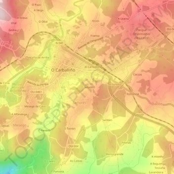
Name: O Tellado topographic map, elevation, terrain.
Location: O Tellado, O Carballiño, Ourense, Galicia, 32500, España (42.40604 -8.09056 42.44604 -8.05056)
Average elevation: 398 m
Minimum elevation: 200 m
Maximum elevation: 516 m
Thank you for supporting this site ❤️
Make a donation
Make a donation