
Thank you for supporting this site ❤️
Make a donation
Make a donation
Ghazni topographic map
Click on the map to display elevation.
Thank you for supporting this site ❤️
Make a donation
Make a donation
Ghazni
Ghazni's climate is transitional between a cold semi-arid climate (Köppen climate classification BSk) and a hot-summer humid continental climate (Dsa). It has cold, snowy winters and warm, dry summers. Precipitation is low and mostly falls in winter (as snow) and spring (as rain). Winters are very cold, with a subzero January daily average temperature of −5.9 °C (21.4 °F), mainly due to the high elevation of the city.
Thank you for supporting this site ❤️
Make a donation
Make a donation
About this map
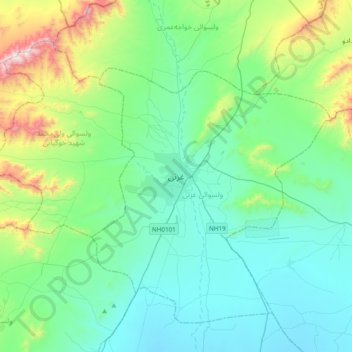
Name: Ghazni topographic map, elevation, terrain.
Location: Ghazni, Ghazni Province, Afghanistan (33.38490 68.25321 33.70490 68.57321)
Average elevation: 2,341 m
Minimum elevation: 2,093 m
Maximum elevation: 3,340 m
Thank you for supporting this site ❤️
Make a donation
Make a donation
Other topographic maps
Click on a map to view its topography, its elevation and its terrain.