
Thank you for supporting this site ❤️
Make a donation
Make a donation
Nye topographic map
Click on the map to display elevation.
Thank you for supporting this site ❤️
Make a donation
Make a donation
About this map
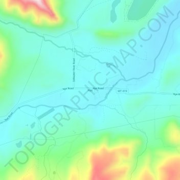
Name: Nye topographic map, elevation, terrain.
Location: Nye, Stillwater County, Montana, 59061, United States (45.41502 -109.82365 45.45502 -109.78365)
Average elevation: 1,535 m
Minimum elevation: 1,441 m
Maximum elevation: 1,865 m
Thank you for supporting this site ❤️
Make a donation
Make a donation
Other topographic maps
Click on a map to view its topography, its elevation and its terrain.