
Kakadu National Park topographic map
Interactive map
Click on the map to display elevation.
About this map
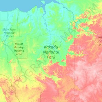
Name: Kakadu National Park topographic map, elevation, terrain.
Average elevation: 140 m
Minimum elevation: -1 m
Maximum elevation: 534 m
Other topographic maps
Click on a map to view its topography, its elevation and its terrain.
Alice Springs
Australia > Northern Territory > Alice Springs
Temperatures in Alice Springs vary widely, and rainfall can vary quite dramatically from year to year. In summer, the average maximum temperature is in the mid-30s, whereas in winter the average minimum temperature can be 5.5 °C (41.9 °F), with an average of 12.4 nights below freezing every year, providing…
Average elevation: 631 m