
Thank you for supporting this site ❤️
Make a donation
Make a donation
Stadtpark topographic map
Click on the map to display elevation.
Thank you for supporting this site ❤️
Make a donation
Make a donation
About this map
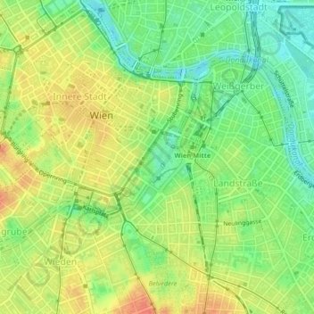
Name: Stadtpark topographic map, elevation, terrain.
Location: Stadtpark, Innere Stadt, Vienna, 1010, Austria (48.20257 16.37695 48.20696 16.38220)
Average elevation: 180 m
Minimum elevation: 156 m
Maximum elevation: 204 m
Thank you for supporting this site ❤️
Make a donation
Make a donation