
Thank you for supporting this site ❤️
Make a donation
Make a donation
Taupaki topographic map
Click on the map to display elevation.
Thank you for supporting this site ❤️
Make a donation
Make a donation
About this map
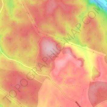
Name: Taupaki topographic map, elevation, terrain.
Location: Taupaki, Taupō District, Waikato, New Zealand (-38.34855 175.71376 -38.34845 175.71386)
Average elevation: 283 m
Minimum elevation: 132 m
Maximum elevation: 342 m
Taupo District trails, hiking, mountain biking, running and outdoor activities
Thank you for supporting this site ❤️
Make a donation
Make a donation
Other topographic maps
Click on a map to view its topography, its elevation and its terrain.