
Thank you for supporting this site ❤️
Make a donation
Make a donation
Puerto Cortés topographic map
Click on the map to display elevation.
Thank you for supporting this site ❤️
Make a donation
Make a donation
About this map
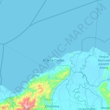
Name: Puerto Cortés topographic map, elevation, terrain.
Location: Puerto Cortés, Cortés, 21301, Honduras (15.59223 -88.17558 16.16378 -87.70052)
Average elevation: 56 m
Minimum elevation: -3 m
Maximum elevation: 1,610 m
Thank you for supporting this site ❤️
Make a donation
Make a donation
Other topographic maps
Click on a map to view its topography, its elevation and its terrain.