
Thank you for supporting this site ❤️
Make a donation
Make a donation
Garvão topographic map
Click on the map to display elevation.
Thank you for supporting this site ❤️
Make a donation
Make a donation
About this map
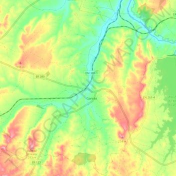
Name: Garvão topographic map, elevation, terrain.
Location: Garvão, Ourique, Beja, Portugal (37.67054 -8.39309 37.75488 -8.30324)
Average elevation: 145 m
Minimum elevation: 87 m
Maximum elevation: 214 m
Thank you for supporting this site ❤️
Make a donation
Make a donation
Other topographic maps
Click on a map to view its topography, its elevation and its terrain.