
Luyos topographic map
Click on the map to display elevation.
About this map
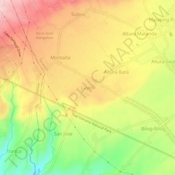
Name: Luyos topographic map, elevation, terrain.
Location: Luyos, Tanauan, Batangas, Calabarzon, 4232, Philippines (14.10213 121.05016 14.14213 121.09016)
Average elevation: 168 m
Minimum elevation: 29 m
Maximum elevation: 284 m