
Río Atoyac topographic map
Interactive map
Click on the map to display elevation.
About this map
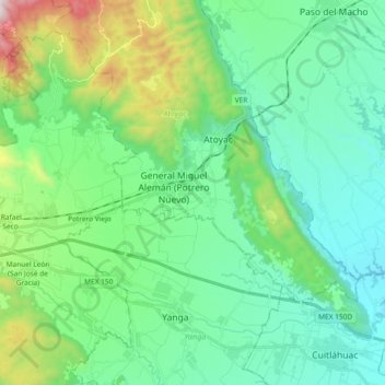
Name: Río Atoyac topographic map, elevation, terrain.
Location: Río Atoyac, Atoyac, Veracruz, México (18.84860 -96.87772 18.92710 -96.69246)
Average elevation: 571 m
Minimum elevation: 276 m
Maximum elevation: 1,566 m
Other topographic maps
Click on a map to view its topography, its elevation and its terrain.
General Miguel Alemán (Potrero Nuevo)
General Miguel Alemán (Potrero Nuevo), Atoyac, Veracruz, 94966, México
Average elevation: 565 m
La Angostura
México > Veracruz > Atoyac > General Miguel Alemán (Potrero Nuevo)
La Angostura, General Miguel Alemán (Potrero Nuevo), Atoyac, Veracruz, 94966, México
Average elevation: 536 m