
Kinleith topographic map
Click on the map to display elevation.
About this map
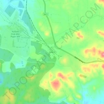
Name: Kinleith topographic map, elevation, terrain.
Location: Kinleith, South Waikato District, Waikato, New Zealand (-38.30337 175.88258 -38.26337 175.92258)
Average elevation: 399 m
Minimum elevation: 360 m
Maximum elevation: 468 m
South Waikato District trails, hiking, mountain biking, running and outdoor activities