
Pagar Alam topographic map
Interactive map
Click on the map to display elevation.
Pagar Alam
Pagar Alam is located by the Bukit Barisan Mountains, at the feet of Mount Dempo. It is situated on the Pasemah Plateau, an extensive fertile highland plain which is surrounded by mountains. It is notable for ancient stone megaliths which surround the town on all sides and are the remnants of a Bronze Age culture. Much of the soil in the city consists of latosol and andisol with rugged and hilly topography. The soil in this city is classified as soil with high fertility (class I).
About this map
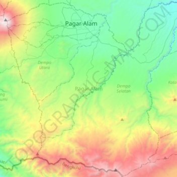
Name: Pagar Alam topographic map, elevation, terrain.
Location: Pagar Alam, South Sumatra, Sumatra, Indonesia (-4.26717 103.13002 -3.98478 103.41541)
Average elevation: 1,293 m
Minimum elevation: 443 m
Maximum elevation: 3,151 m
Other topographic maps
Click on a map to view its topography, its elevation and its terrain.