
Thank you for supporting this site ❤️
Make a donation
Make a donation
Gangani topographic map
Click on the map to display elevation.
Thank you for supporting this site ❤️
Make a donation
Make a donation
About this map
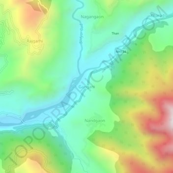
Name: Gangani topographic map, elevation, terrain.
Location: Gangani, Rajgarhi, Uttarkashi district, Uttarakhand, India (30.80901 78.23287 30.84901 78.27287)
Average elevation: 1,551 m
Minimum elevation: 1,204 m
Maximum elevation: 2,232 m
Thank you for supporting this site ❤️
Make a donation
Make a donation
Other topographic maps
Click on a map to view its topography, its elevation and its terrain.