
Aguas Calientes topographic map
Interactive map
Click on the map to display elevation.
About this map
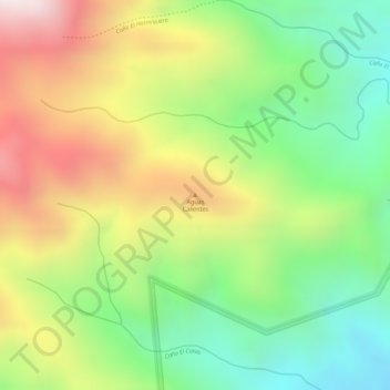
Name: Aguas Calientes topographic map, elevation, terrain.
Average elevation: 623 m
Minimum elevation: 290 m
Maximum elevation: 1,017 m
Other topographic maps
Click on a map to view its topography, its elevation and its terrain.
Managua
Nicaragua > Departamento de Managua > Managua
Managua, Managua (Municipio), Departamento de Managua, 10000 (CODIGO MAESTRO), Nicaragua
Average elevation: 194 m
Ometepe Island
Ometepe Island, Altagracia (Municipio), Rivas, 48800, Nicaragua
Average elevation: 39 m