
Nghe An province topographic map
Interactive map
Click on the map to display elevation.
About this map
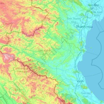
Name: Nghe An province topographic map, elevation, terrain.
Location: Nghe An province, Vietnam (18.55212 103.87456 19.99840 105.94930)
Average elevation: 484 m
Minimum elevation: -1 m
Maximum elevation: 2,563 m