
Thank you for supporting this site ❤️
Make a donation
Make a donation
Baker County topographic map
Click on the map to display elevation.
Thank you for supporting this site ❤️
Make a donation
Make a donation
About this map
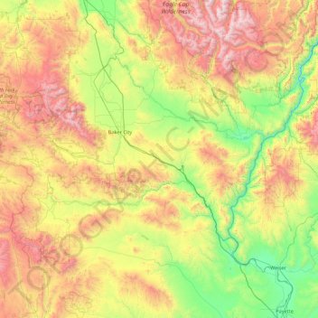
Name: Baker County topographic map, elevation, terrain.
Location: Baker County, Oregon, United States (44.25508 -118.51996 45.08108 -116.78390)
Average elevation: 1,342 m
Minimum elevation: 515 m
Maximum elevation: 2,968 m
Thank you for supporting this site ❤️
Make a donation
Make a donation
Other topographic maps
Click on a map to view its topography, its elevation and its terrain.