
Thank you for supporting this site ❤️
Make a donation
Make a donation
La Labor topographic map
Click on the map to display elevation.
Thank you for supporting this site ❤️
Make a donation
Make a donation
About this map
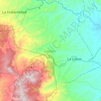
Name: La Labor topographic map, elevation, terrain.
Location: La Labor, Ocotepeque, Honduras (14.43460 -89.08603 14.55648 -88.96920)
Average elevation: 1,323 m
Minimum elevation: 850 m
Maximum elevation: 2,261 m
Thank you for supporting this site ❤️
Make a donation
Make a donation
Other topographic maps
Click on a map to view its topography, its elevation and its terrain.